Mozambique Map for PowerPoint & Google Slides
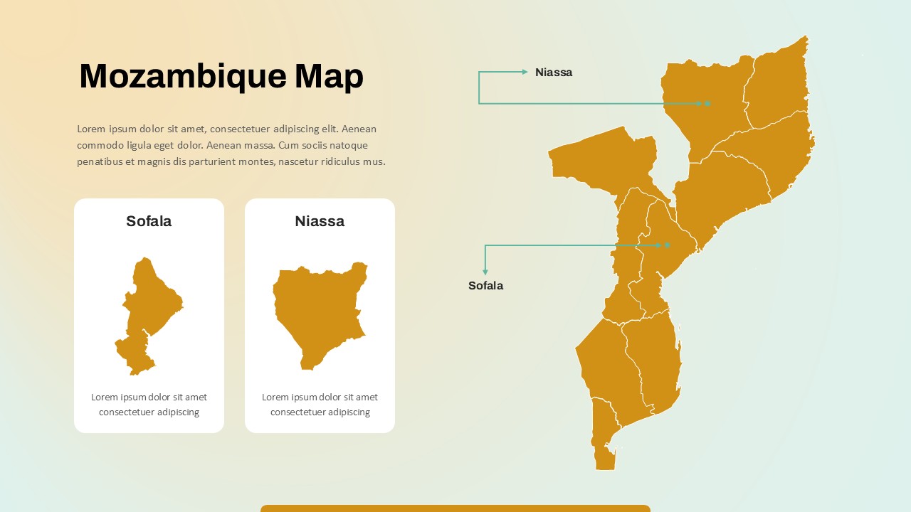
This Mozambique map slide offers a clear, editable visualization of the country’s geographic layout, with detailed focus on the provinces of Sofala and Niassa. The right side of the slide showcases the full map of Mozambique in a warm ochre tone, marked with province boundaries and pinpoint markers. Two key provinces—Sofala in the central region and Niassa in the north—are distinctly highlighted with labeled callouts and enlarged silhouettes to the left, allowing presenters to zoom in on regional insights.
Designed with presentation clarity in mind, the layout uses minimalist visuals and intuitive color coding for easy audience comprehension. The contrasting white background boxes for Sofala and Niassa make their boundaries stand out, suitable for thematic presentations around regional demographics, economics, or development projects. Placeholder text below each province allows for quick insertion of data, facts, or project-specific context.
Fully compatible with both PowerPoint and Google Slides, this map slide is ideal for use in policy briefs, educational content, or NGO field reports. Its drag-and-drop usability, editable shapes, and responsive layout make geographic storytelling seamless and visually impactful across platforms.
See more

Aspect Ratio
16:9Item ID
SKT03720
Features of this template
Other Uses
Beyond Mozambique-specific reports, this template can support academic geography lessons, humanitarian fieldwork briefs, travel market research, or infrastructure project proposals. Adapt the layout to spotlight other provinces or themes such as population density, resource distribution, or election mapping.
FAQs
You May Also Like These Presentation Templates


- Free

- Free
- Free