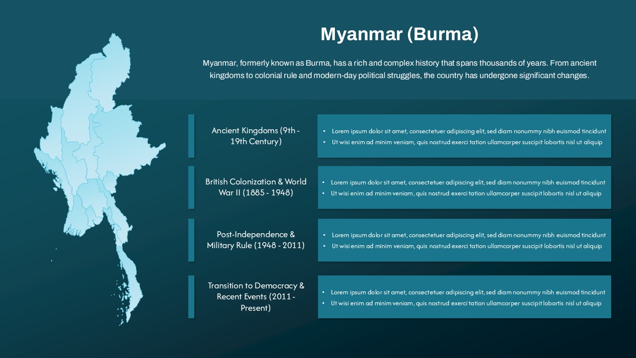
Editable Niger Country Map Slide for PowerPoint & Google Slides
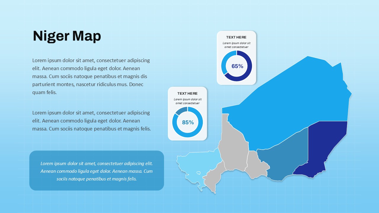
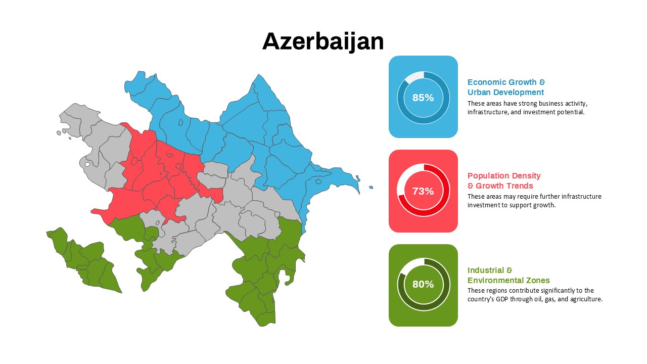
Showcase regional data or business insights with this editable Niger map slide, designed to combine geographic precision with modern infographic elements. The layout features a fully segmented map of Niger, with distinct regions color-coded for clarity. Alongside the map, two circular percentage indicators (65% and 85%) are embedded in clean, shadowed containers—ideal for displaying regional performance metrics, market penetration, or demographic statistics.
A spacious text area on the left provides room for contextual information or strategic commentary, while the map on the right allows for targeted visual storytelling. The color segmentation and clean infographic design support intuitive comparisons across different states or data categories, making the slide ideal for strategy, development, or government presentations.
Optimized for PowerPoint and Google Slides, this asset includes customizable shapes, editable percentage charts, and flexible text blocks—empowering users to tailor content for sectoral reports, regional reviews, or investment proposals. The high-contrast palette and gradient background enhance visual appeal without overpowering the content, supporting clarity in any professional setting.
See more

Aspect Ratio
16:9Item ID
SKT03627
Features of this template
Other Uses
Repurpose this slide for educational content, health sector analytics, development program tracking, or logistical planning across Niger. It’s also well-suited for illustrating sales distribution, infrastructure development, or project funding allocations by region.
FAQs
You May Also Like These Presentation Templates


- Free
- Free


- Free