Afghanistan Map Template for PowerPoint and Google Slides
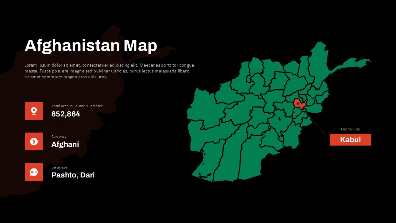
The Afghanistan Map Presentation Template offers a detailed, visually striking geographic overview of the country—perfect for educational, governmental, business, or research presentations. Highlighting the capital city Kabul, national boundaries, and regional divisions, this template is a must-have tool for anyone needing to showcase location-specific data related to Afghanistan.
The dark background and contrasting map visuals ensure clarity and focus. Key statistics are prominently displayed, including total area (652,864 km²), national currency (Afghani), and official languages (Pashto and Dari)—making this template an excellent choice for demographic briefings, geopolitical discussions, and cultural insights. The map’s bold red pointer to Kabul adds a professional and intuitive touch to the design, helping presenters guide their audience visually.
This template is ideal for geography lessons, policy presentations, humanitarian reports, and international relations studies. It supports content delivery on Afghanistan’s administrative layout, economic zones, or regional programs with impactful visuals. Fully editable in both PowerPoint and Google Slides, users can customize colors, labels, and icons to align with their data and presentation style.
Whether you’re an educator explaining Central Asian geopolitics, a researcher presenting field data, or a development agency discussing regional initiatives, this map template ensures a polished and informative delivery.
See more

Aspect Ratio
16:9Item ID
SKT03562
Features of this template
Other User Cases of the Template:
Geography education, government reports, NGO presentations, research briefings, regional development analysis, policy advocacy, trade and investment pitches, academic lectures, conflict and peace studies, cultural awareness trainingFAQs
You May Also Like These Presentation Templates


- Free

- Free

- Free
- Free
- Free

- Free
- Free

- Free
- Free
- Free
- Free